On this page
- Where exactly is Tanjung Bira?
- Why does the cape have two coasts?
- How do Bira, Bara and Panrang Luhu relate?
- Is Tanjung Bira the southern tip of Sulawesi?
- Which islands sit off the cape?
- How did Bonto Bahari come to be one district?
- Who visits Tanjung Bira?
- What else should you know about Tanjung Bira?
- Which sources support this page?
- How do I reach the desk?
By Bira Sulawesi Editorial Desk
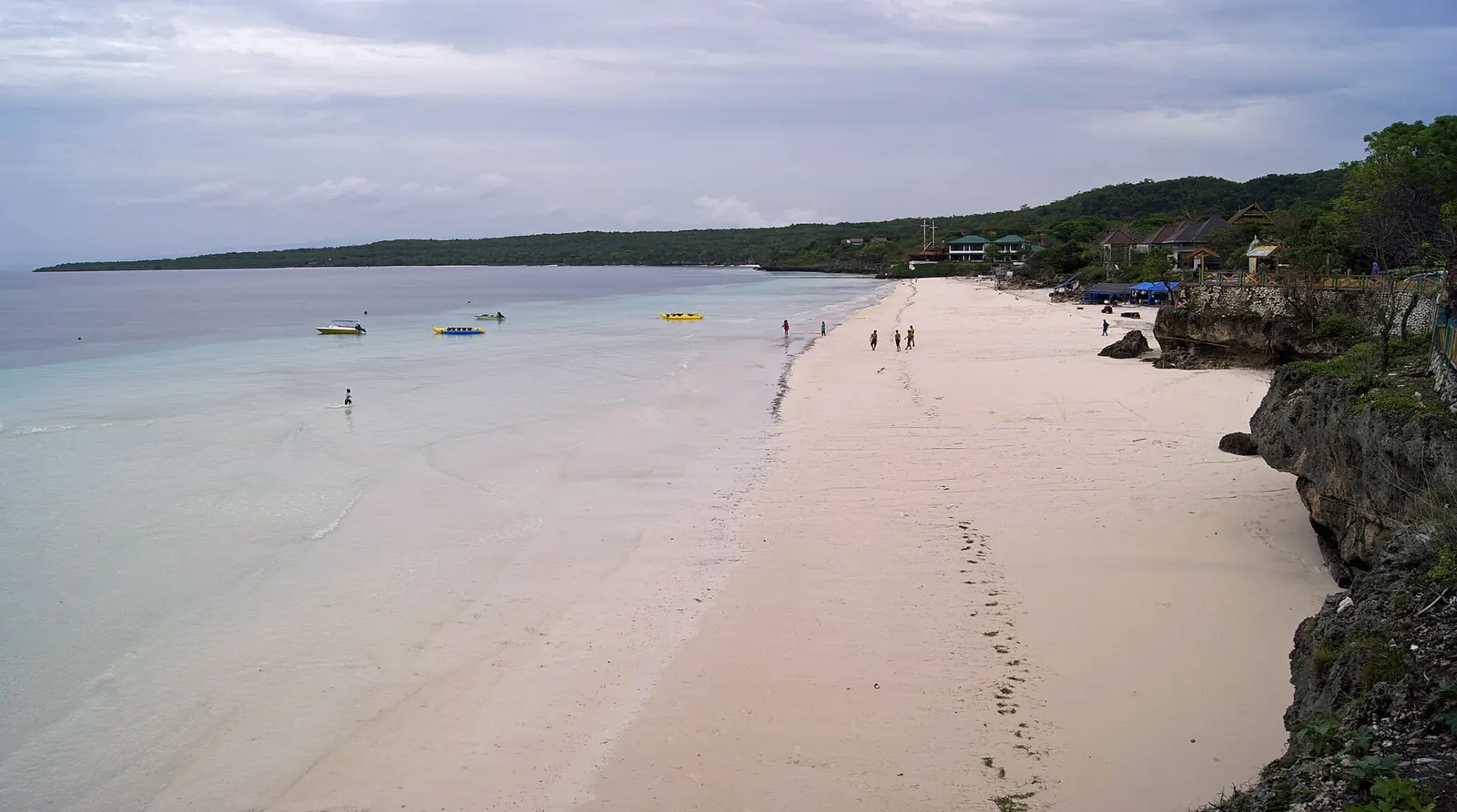
Tanjung Bira is a cape in Bonto Bahari district, Bulukumba Regency, South Sulawesi, Indonesia. The name covers a village, a beach and the wider headland, with the Flores Sea on one side and the Gulf of Bone on the other. Makassar is about 200 km away by road, and Liukang Loe and Kambing islands lie offshore.
Where exactly is Tanjung Bira?
On paper, Bira is a village. Wikipedia places it in Bonto Bahari district, Bulukumba Regency, and describes its coast as the destination known as Tanjung Bira. You will see the district spelled both Bonto Bahari and Bontobahari; they are the same place. The regency around it has its capital at Ujung Bulu, covers 1,175.53 sq km and had a mid-2025 population estimate of 485,008, according to Wikipedia citing the statistics agency BPS.
If you want a pin for a Tanjung Bira map, Wikipedia gives the village at 5°35′01″S 120°27′21″E, or -5.5836, 120.4558. That point is the village centre, so a map app will not drop you on a beach or at the end of the cape. Save your actual lodging or beach as its own pin. The Bira Sulawesi overview covers the whole area in brief.
For a sense of scale, the national tourism site gives about 200 km and roughly 5 to 6 hours overland from Makassar. Other sources give different drive times, and the Makassar to Bira road guide compares them. The table below is the mental map: what lies where, and who says so.
| Place | Where it sits | Who says so |
|---|---|---|
| Bira village | Village centre at -5.5836, 120.4558, not the tip of the cape | Wikipedia |
| Bara Beach | Roughly 2.5 km west-north-west of Bira village, along the sand | Seascapes Bira, a resort based on Bara Beach |
| Panrang Luhu Beach | East-facing, about 1.5 km north to south, with Bira port at its south end | Tourism ministry village platform |
| Titik Nol | About 2 km from Bira Beach | Detik, May 2024 |
| Apparalang cliffs | In Ara village, thirty to forty minutes north by road | Pedoman Karya for the village; Seascapes for the time |
| Tana Beru yards | 20 to 30 minutes back towards Bulukumba | Seascapes Bira |
| Liukang Loe island | About 3.5 km offshore from Bira and Bara beaches | Detik, May 2024 |
Why does the cape have two coasts?
Tanjung Bira narrows to a point between two seas. The Seascapes Bira guide says the western side faces the Flores Sea and gets the sunset, while the eastern side faces the Gulf of Bone and gets the sunrise. That is an operator's summary, but the national tourism site agrees on the effect, saying sunrise and sunset can both be seen in the Tanjung Bira area because of the shape of the cape.
The split decides where you sleep and when you go out. A room advertised for its sunset view belongs on one side and a dawn walk on the sand belongs on the other. Shelter also changes from one side to the other. Seascapes describes its own Bara Beach cove as sheltered from the prevailing south-easterly wind, a claim from a business based there, so read it with that in mind. How wind shifts through the year is covered in the guide to the best time to visit Bira.
How do Bira, Bara and Panrang Luhu relate?
A Tanjung Bira travel guide has to keep these three names apart, because each is a different shore.
- Bira is the village and also the main beach. When a listing says "Bira", check which of the two it means. The busy stretch has its own guide to Bira Beach.
- Bara is the next sand along. The Seascapes guide calls it walkable from Bira village in about half an hour, while Sulawesi.com, which sells tours, says about twenty minutes when the tide is right. Seascapes' Bara page gives about 2.4 km against 2.5 km in its guide, a small difference from the same operator. Bara Beach compared with Bira goes further.
- Panrang Luhu is on the other coast. The tourism ministry's village platform describes about 1.5 km of east-facing sand with a pinisi yard at the north end and the port at the south. The platform calls it more natural than Bira and Bara. See the Panrang Luhu Beach guide for sunrise, camping and the yard.
North of Panrang Luhu, the Seascapes guide lists three more eastern beaches, Kasuso, Mandala Ria and Samboang, used mostly by domestic visitors. Anyone reading older travel notes should expect spellings to shift, so Panrang Luhu also appears as Panrangluhu, and Tana Beru as Tanaberu.
Is Tanjung Bira the southern tip of Sulawesi?
The sources conflict. The national tourism site describes Tanjung Bira Beach as at the southernmost tip of the Sulawesi mainland. The Seascapes guide says the point at Cape Bira is not the true southernmost point of Sulawesi.
One is a government promotion page and the other is a resort's guide, so neither settles the matter on its own, and this page does not claim to. For your trip it changes little. If you want a clifftop viewpoint, read about the Titik Nol viewpoint and glass bridge.
Which islands sit off the cape?
Liukang Loe lies in the Flores Sea and belongs administratively to Bira village, according to Wikipedia, which gives its name as meaning "many black woods". Detik puts it about 3.5 km from Bira and Bara beaches. The tourism ministry's village platform describes two villages on it, so this is a lived-in island with people and boats coming and going. The Liukang Loe island guide covers the crossing.
Kambing is a small, uninhabited rocky island further out, also marked on maps as Pulau Sarontang according to Seascapes. Detik calls it rarely visited, and its distance is itself disputed. See Kambing Island diving before you assume it is an easy boat ride, and diving in Bira for the reefs around both islands.
How did Bonto Bahari come to be one district?
The district's history explains why names overlap. According to Wikipedia's entry on Ara, Bonto Bahari was first called Tanah Bale, a merger of the old districts of Tanah Beru, Bira, Ara and Lemo-lemo, and it took its present name after a 1967 proposal. So four communities that you may meet separately on a map share a single administrative label.
Those same names run through the boatbuilding story. Wikipedia says the first Sulawesi pinisi is thought to have been built in 1906 by shipbuilders of Ara and Lemo-Lemo for a Bira skipper. In 2017 UNESCO inscribed the art of boatbuilding in South Sulawesi on its Representative List. That inscription covers a craft and not a place, so Tanjung Bira is not a World Heritage Site, whatever a caption may tell you. For the yards themselves, read about visiting the Tana Beru boatyards.
Who visits Tanjung Bira?
Mostly Indonesians, on the zone management counts reported by Antara for 2024. The Bira Beach page gives the figures.
If you are coming from abroad, expect a domestic holiday place first. That shapes the rhythm of the beach, with busier days when people drive down from Makassar, and it means reports written for foreign divers describe only a small part of who is here. Compare the stretches in where to stay in Bira, then build your days from things to do in Bira and the Tanjung Bira itinerary.
What else should you know about Tanjung Bira?
Where is Tanjung Bira in South Sulawesi?
It is in Bonto Bahari district, Bulukumba Regency, about 200 km by road from Makassar according to the national tourism site. Wikipedia gives the village centre at -5.5836, 120.4558.
What does tanjung mean in Tanjung Bira?
English-language guides such as the Seascapes resort guide write the name as Cape Bira, so tanjung reads as cape. Bira is also the name of the village behind the coast.
Which district is Tanjung Bira in?
Bonto Bahari, sometimes written Bontobahari. Wikipedia says the district was first called Tanah Bale and took its present name after a 1967 proposal.
Is Tanjung Bira the southern tip of Sulawesi?
Sources disagree. The national tourism site calls it the southernmost tip of the Sulawesi mainland, while the Seascapes resort guide says the point at Cape Bira is not the true southernmost point.
Is Tanjung Bira a UNESCO World Heritage Site?
No. In 2017 UNESCO inscribed the art of boatbuilding in South Sulawesi on its Representative List. That listing covers a craft, and no place on the cape is inscribed.
Which sources support this page?
- Wikipedia (Indonesian): Bira, Bonto Bahari, Bulukumba
- Wikipedia: Bulukumba Regency
- Indonesia Travel (national tourism site): Pantai Tanjung Bira
- Seascapes Bira (resort): Tanjung Bira guide
- Seascapes Bira (resort): Bara Beach page
- Sulawesi.com (sells tours and car hire): Bira, what it does well
- Tourism ministry village platform (Jadesta): Pantai Panrangluhu
- Wikipedia (Indonesian): Pulau Liukangloe
- Tourism ministry village platform (Jadesta): Pulau Liukang Loe
- Wikipedia (Indonesian): Ara, Bonto Bahari, Bulukumba
- Wikipedia: Pinisi
- UNESCO: Pinisi, art of boatbuilding in South Sulawesi
- Antara: foreign visitors to Tanjung Bira in 2024
- Detik: 10 spots in the Tanjung Bira area (8 May 2024)
- Pedoman Karya: Desa Ara, May 2024
How do I reach the desk?
Bira Sulawesi is a guide with a request desk. It is not a resort, dive centre or tour operator. If you are unsure which side of the cape suits your dates, send them with your group size and what you want to do, on WhatsApp 6281139414563 or at bd@juaraholding.com.
A request can lead to a paid booking, so we have a commercial interest. Any fee, price and the company contracting with you are stated in a written offer before you agree, and nothing on this page is an offer.
Send the desk your dates, group size, and what you want to do. The desk replies in writing.
Ask the desk on WhatsApp bd@juaraholding.com